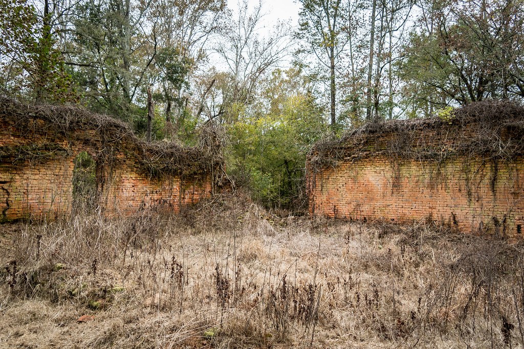
The brick warehouse
Four roofless walls and a row of empty windows, the most photographed ruin in the village and the easiest to reach.
How the mills workedPlan your visit
Scull Shoals is a real forest site, not a museum. You park at the top of the hill, walk down through the pines, and the village appears piece by piece: brick walls, foundations, the river.
Directions
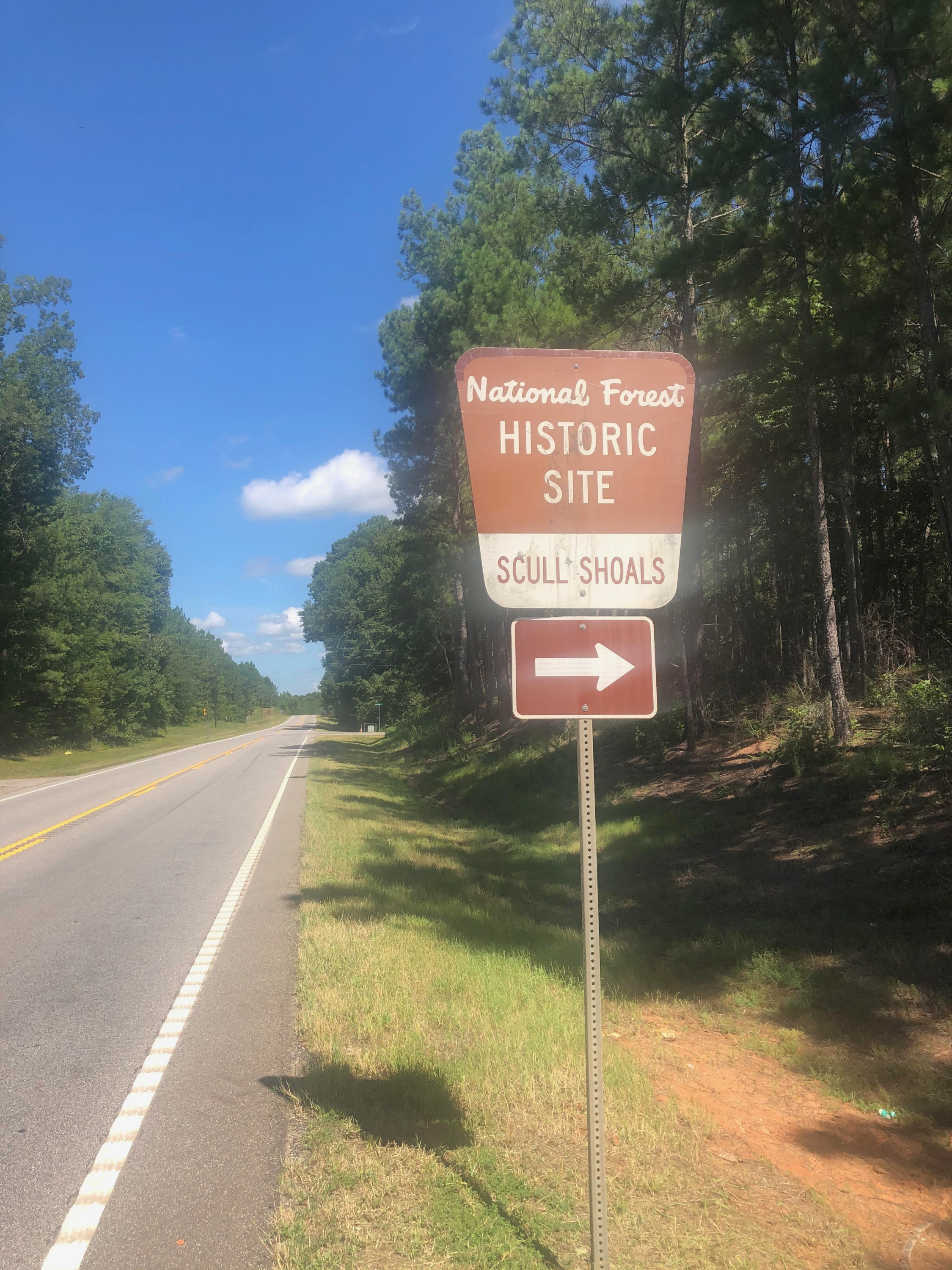
The route has not changed in decades: highway, farm road, gravel. Each historic sign below is one you will actually pass on the way in.
Step 1
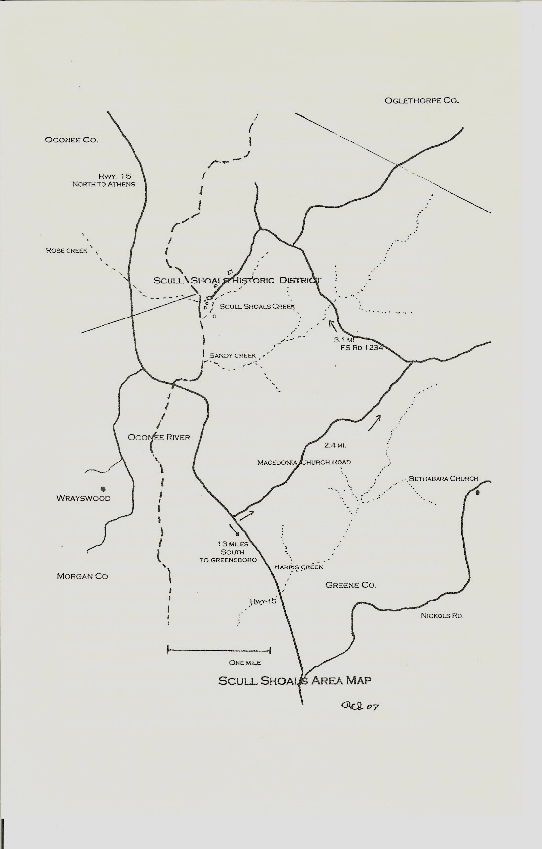
From Greensboro, take Highway 15 north about 13 miles to the brown historic site sign on the right. Turn right onto Macedonia Road and follow it 2.1 miles.
Step 2
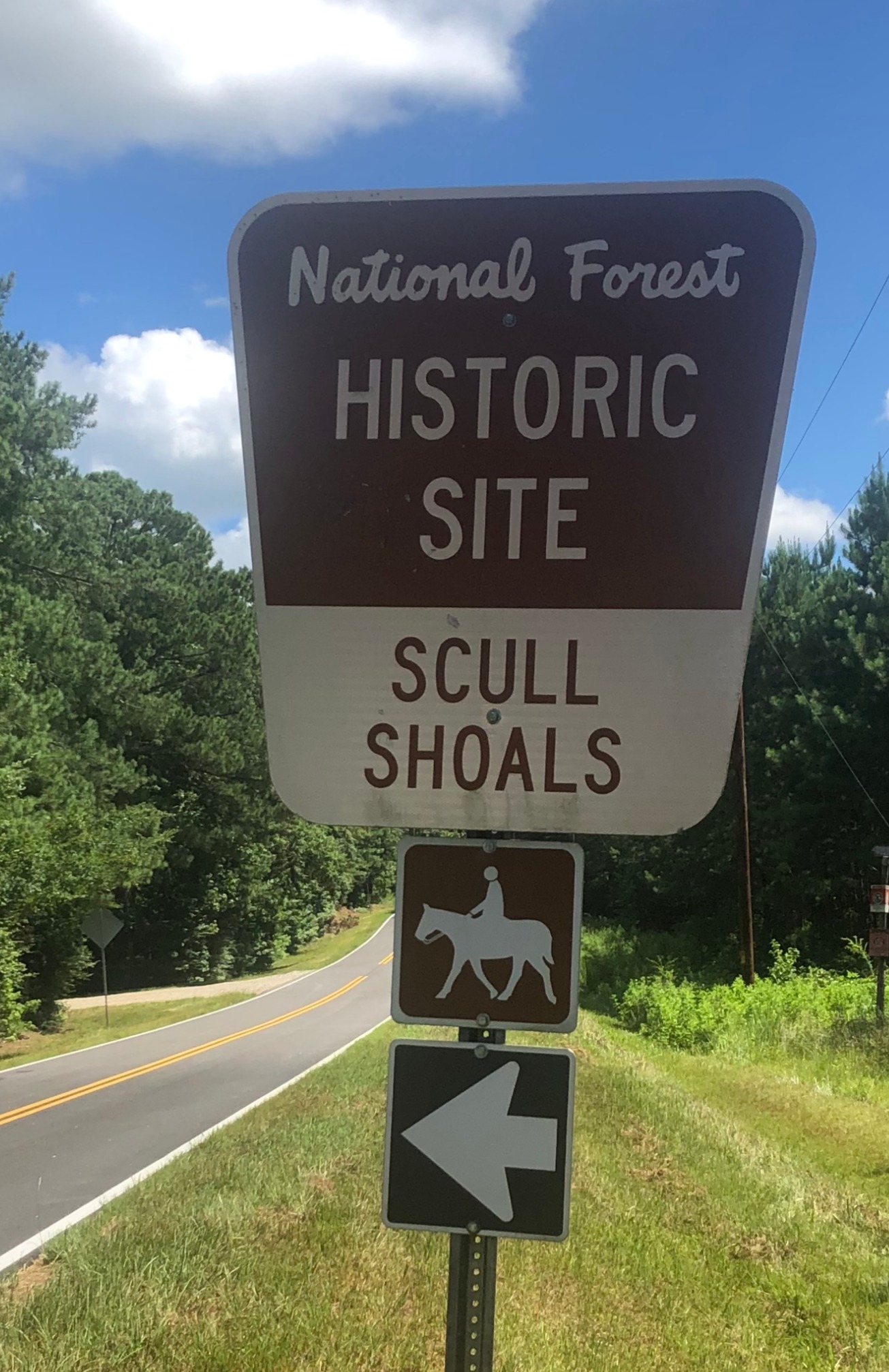
At the Scull Shoals sign, turn left onto the gravel forest road. The brown sign and its left arrow mark the turn.
Step 3
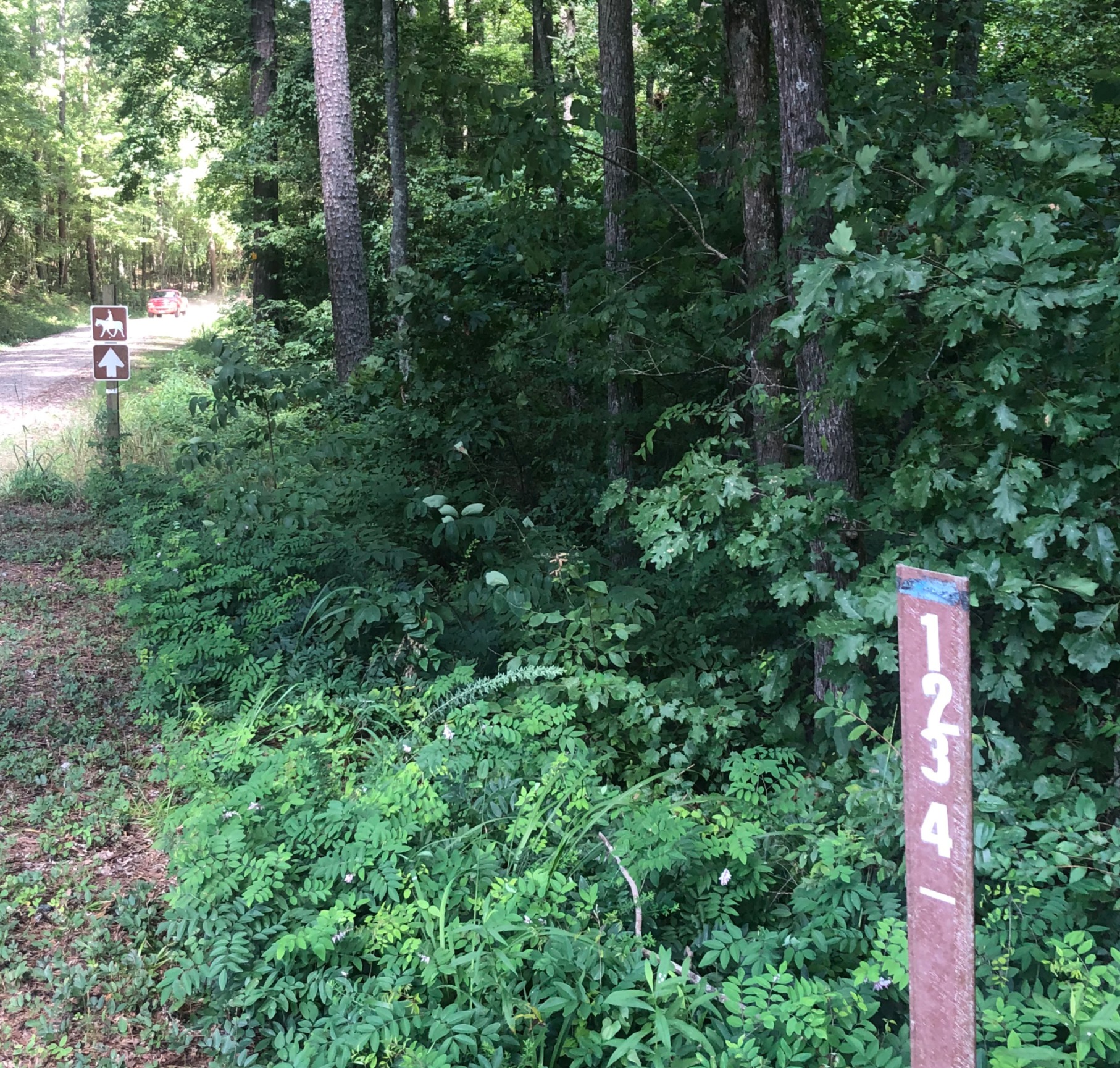
Follow the numbered forest road markers and stay on the main gravel track. The last historic signs guide you in.
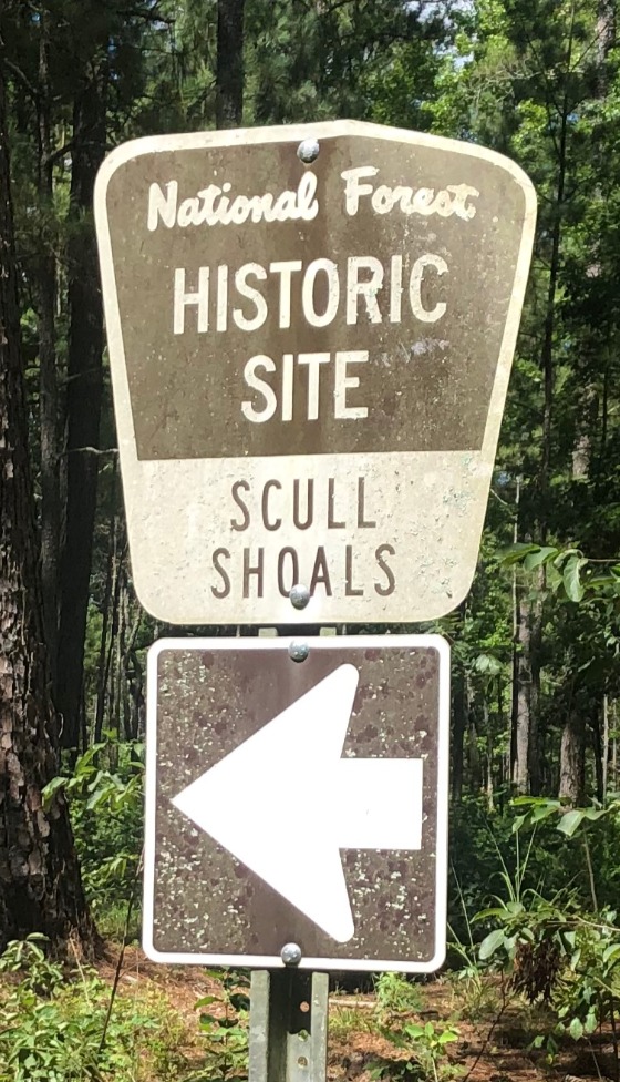
Step 4
The road ends at the parking area above the ruins. From there it is a short walk down to the warehouse walls and the river.
Coming from Athens or Watkinsville? Approach on Highway 15 from the north instead, and the Macedonia Road turn comes from the other side. The gravel section is the same.
Where you are going
The site has no postal street address. Search for “Scull Shoals Historic Site” in your maps app, or navigate to the junction of Macedonia Road and Forest Service Road 1234 and follow the signs from there.
The Friends’ mailing address is a post office box in Greensboro. It is for letters, membership and donations, not for finding the ruins.
What you will see
The walk from the parking area to the river and back is short. Most visitors stay an hour; bring a picnic and it becomes an afternoon.
Four roofless walls and a row of empty windows, the most photographed ruin in the village and the easiest to reach.
How the mills worked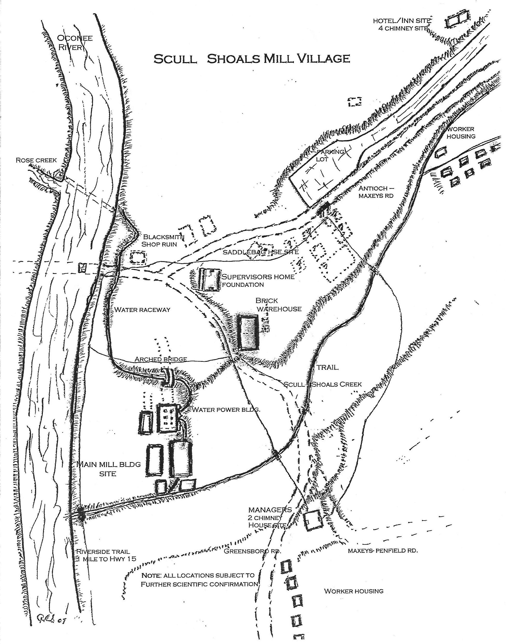
Low brick and stone traces of the cotton factory, the paper mill and the tall stack that marked the works from the river.
What the digging found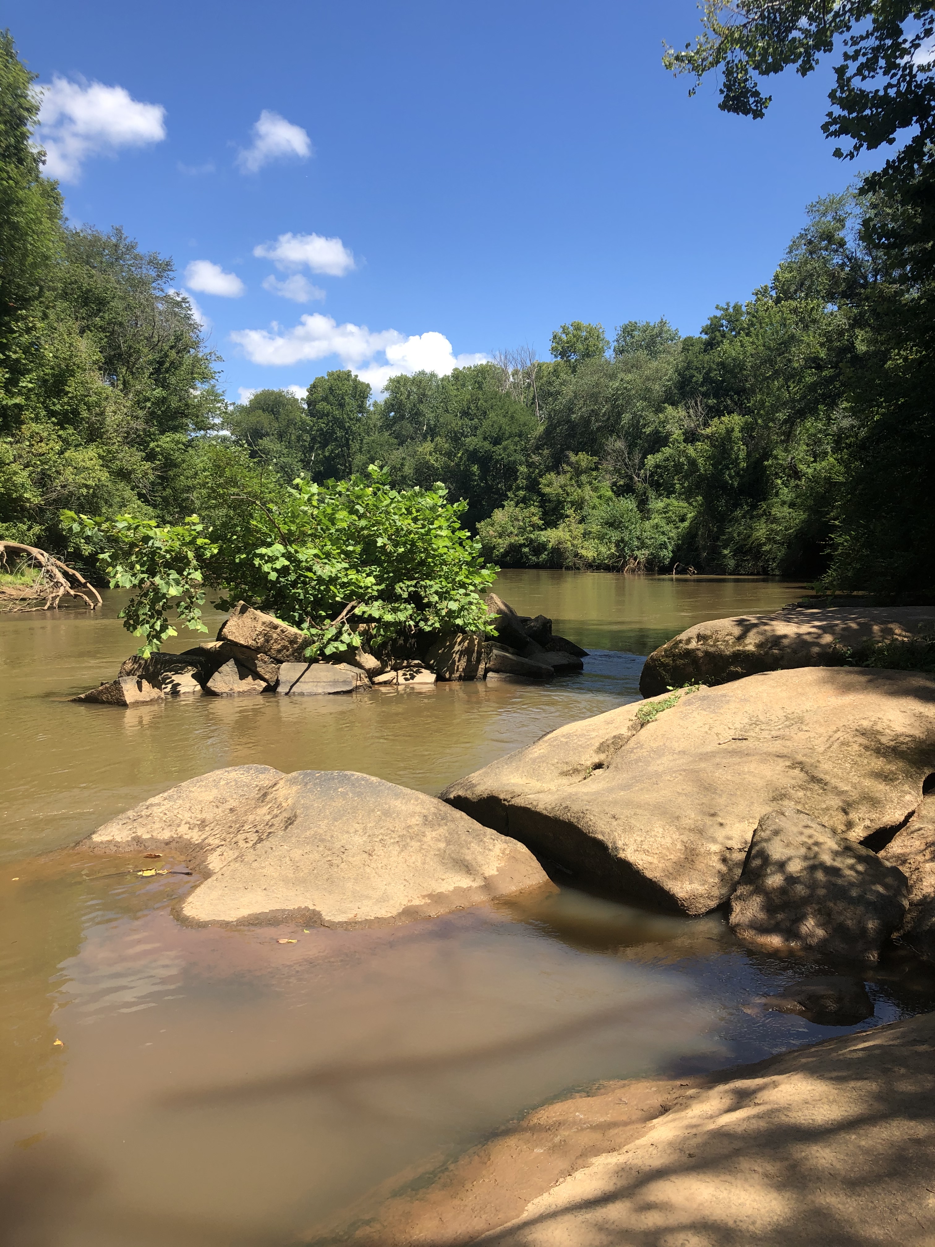
The rock ledges that gave the village its power, and the trail that follows the river past the old dam site.
A river that powered a village
A living recreation of the medicinal garden kept by the village’s herb doctor family, planted and tended by volunteers.
Meet the DurhamsBefore you go
Nothing here is difficult, but the site is a forest, not a park with paths and signs at every turn.
There is no gate, no ticket and no staffed visitor centre. The site is part of the Oconee National Forest and open daily during daylight hours.
Forest Service Road 1234 is unpaved for 3.1 miles. Take it slowly, and expect washboard and puddles after rain.
The walk down to the ruins is short but uneven, with roots, loose brick and open foundations. Boots or sturdy trainers are best.
There is no shop, no fountain and patchy cell service. Download directions before you leave Greensboro.
Everything here is protected by federal law. Leave brick, stone and artifacts where they lie, and stay off the exposed walls.
Ticks and chiggers are part of the Georgia woods. Long trousers and insect repellent make the walk far more pleasant.
Access and groups
The parking area and the path down are on forest soil, with roots, ruts and a slope. There are no paved surfaces and no handrails. Visitors with limited mobility can see the warehouse from the top of the hill, but the river trail is not wheelchair accessible.
School groups, scouts and historical societies are welcome. The Friends can help plan a walk, but the contact page is not built yet.
Site rules
After the walk
Friends of Scull Shoals maintains the trails, replants the herb garden and keeps the archive. Come see the village, then help keep it standing.